


- Obecnie brak na stanie


Information about the position of a user's mobile handheld (wireless) device allows a network operator to pinpoint the position of a customer in relation to their network infrastructure. This technology enables a multitude of applications in a wide range of fields: sensor networks, geographic information, location management, location-based billing, emergency services, location-based advertising, intelligent transportation, and leisure applications, among others. The availability of a ubiquitous, ever-available positioning system would allow the development of new opportunities and business models, creating innovative products and the delivery of highly personalized services.
Location-aware applications are finally on the brink of revolutionizing the way in which people go about their business on a daily basis. Of the top 50 Android applications chosen by Google, about 1 in 7 was built using the GPS functionality. Nokia has developed GPS-enabled handsets, such as the N95, and navigation solution packages. And of course, the iPhone's location-aware APIs are being used by developers for all sorts of applications, allowing users to:
This book describes the state-of-the-art on positioning techniques, combining for the first time both satellite and terrestrial methods. Taking a signal processing approach, the book focuses on such techniques as signal tracking, parameter estimation and data post-processing and filtering, which are becoming the core of every positioning receiver. The first section is dedicated to the presentation of the different positioning solutions, both satellite and terrestrial, examining the different existing techniques used and discussing their limitations. The performance and accuracy of various methods and their fundamental bounds are evaluated, and new perspectives and algorithms are discussed. In keeping with the signal processing approach, one section discusses innovative technologies for wireless positioning, and another looks more closely at cognitive radio and cognitive positioning.
Coverage is also given to the hot topics of co-operative positioning (CPS) and inertial navigation (INS). CPS provides a more reliable service over long distances, and can be used in an uncharted environment and in three dimensions, allowing users to navigate unfamiliar surroundings with ease. INS allows position location without the need for external references, making it immune to outside interference and therefore extremely useful for military applications on ships, aircraft, submarines and guided missiles.
Feature: Combines satellite and terrestrial positioning techniques, using a signal processing approach.
Benefit: Enables the development of higher quality, more flexible and effective products: for example, merging these two technologies will reduce the complexity and processing time taken to receive an accurate GPS location when using a satellite-terrestrial phone.
Feature: Discusses the applicability of developed techniques to emerging standards, such as LTE Advanced or WiMAX II, through the issue of ranging measurement with multicarrier signals.
Benefit: Gives engineers the knowledge to develop new and innovative position location-based applications, with confidence that they will be compatible with both current and next generation networks.
Feature: Contains quantitative performance results for ranging, positioning, and tracking for various systems.
Benefit: Provides engineers with concrete data that will allow them to evaluate different systems and choose the most appropriate techniques for the products they are developing.
1 Introduction
1.1 The General Issue of Wireless Position Location
1.2 Positioning and Navigation Systems
1.3 Channel-model-based Ranging and Localization
2 Satellite-based Navigation Systems
2.1 Global Navigation Satellite Systems (GNSS)
2.2 Regional Navigation Satellite Systems (RNSS)
2.3 GNSS Receivers
2.4 Augmentation Systems and Assisted GNSS
3 Terrestrial Network-based Positioning and Navigation
3.1 Fundamental Positioning and Navigation Techniques in Terrestrial Networks
3.2 Cellular Networks
3.3 Wireless LANs and Wireless MANs
3.4 UWB and Wireless Sensor Networks
4 Fundamental Limits in the Accuracy of Wireless Positioning
4.1 Parameter Estimation and Positioning
4.2 The Cramér-Rao Bounds Family
4.3 The Ziv-Zakai Bounds Family
4.4 Application of the Accuracy Bounds to Positioning Issues
4.5 Accuracy Bounds and the Multipath Channel
5 Innovative Signal Processing Technologies for Wireless Positioning
5.1 Cooperative Positioning and Localization
5.2 Signal Processing for Hybridization
6 Cognitive Radio and Cognitive Positioning
6.1 Software Defined Radio Technologies
6.2 Flexible and Cognitive radio
6.3 Spectrum Sensing
6.4.Cognitive Positioning with Multicarrier Signals
7 Conclusions and Perspectives
Pololu 42x19mm Idler Wheel/Sprocket Pair - White
Brak towaru
Brak towaru
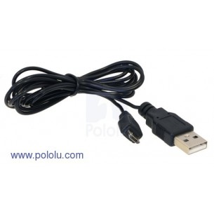
Kabel z wtykami USB typ A oraz micro-USB typ B, kabel o długości 1.5m. Kabel ma średnicę 2mm, działa w trybach USB Low-speed oraz Full-speed. Pololu 1938
Brak towaru
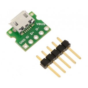
Płytka z gniazdem micro USB z wyprowadzonymi na złącze goldpin (2,54 mm) liniami USB. Pololu 2592
Brak towaru
T1 (3mm) Yellow LED with Yellow Diffused Lens
Brak towaru
T1 (3mm) Red LED with Red Diffused Lens
Brak towaru
T1 (3mm) Green LED with Green Diffused Lens
Brak towaru
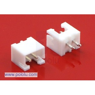
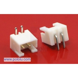
2.5 mm JST XH-Style Shrouded Male Connector: 2-Pin, Straight
Brak towaru
2.5 mm JST XH-Style Shrouded Male Connector: 2-Pin, Right Angle
Brak towaru
2.5 mm JST XH-Style Shrouded Male Connector: 2-Pin, Right Angle Extended
Brak towaru
T1 (3mm) Blue LED with Light Blue Diffused Lens
Brak towaru
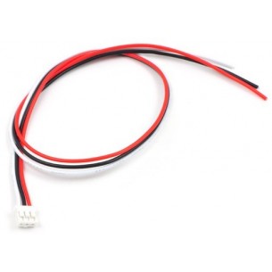
Kabel 3-żyłowy o długości 30 cm z żeńskim wtykiem JST, raster 2mm, stosowany m.in. z czujnikami odległości firmy Sharp. Pololu 117
Brak towaru
Brak towaru
Brak towaru
Brak towaru
Brak towaru