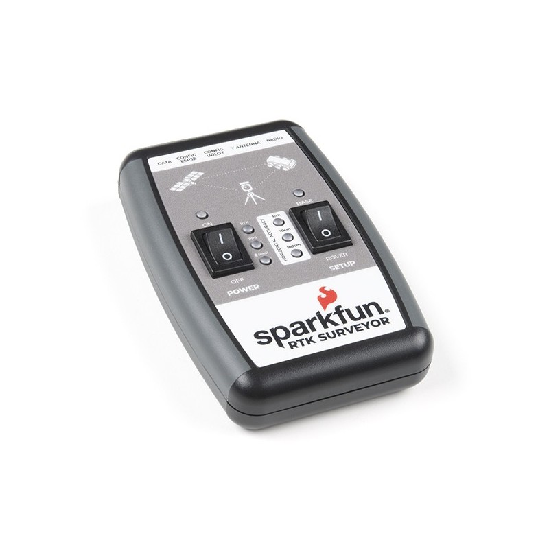

SparkFun RTK Surveyor is a GNSS receiver designed for positioning with high accuracy at the centimeter level for applications in surveying. The device can also be used for autonomous driving, navigation and tracking. With two sets, RTK systems with an accuracy of up to 14 mm can be created. The receiver has a built-in Bluetooth ESP32 WROOM module that allows the user to use RTK Surveyor via an application on a phone or tablet.
RTK Surveyor can be used in four modes:
The set includes two cables enabling the user to connect a telemetry radio. If the local correction source is within 10 km, the user can also use the phone to provide the correction data via Bluetooth. Full documentation with examples of use is available on the product page.
Attention!
The kit does not include the antenna, serial telemetry radio, or associated mounting hardware. These items must be purchased separately.GNSS Receiver: ZED-F9P
Bluetooth Transceiver: ESP32 WROOM
Overall Device
Manufacturer BTC Korporacja sp. z o. o. Lwowska 5 05-120 Legionowo Poland sprzedaz@kamami.pl 22 767 36 20
Responsible person BTC Korporacja sp. z o. o. Lwowska 5 05-120 Legionowo Poland sprzedaz@kamami.pl 22 767 36 20
GPS antenna, internal, SMA-A, 5m, straight, magnet
Function module designed for MicroMod boards. Equipped with GPS with NEO-M9N 92-channel GNSS receiver. The system can receive data from all major positioning systems: GPS, GLONASS, Galileo and BeiDou. It communicates via UART, I2C and SPI interfaces. SparkFun GPS-18378
No product available!
Function module designed for MicroMod boards. Equipped with the ZED-F9P GNSS receiver. The system can receive data from all major positioning systems: GPS, GLONASS, Galileo and BeiDou. It communicates via UART, I2C and SPI interfaces. SparkFun GPS-18378
No product available!
Module with GNSS MAX-M10S receiver. It can receive signals from GPS, GLONASS, BeiDou and Galileo constellations. It has an SMA connector for connecting an external antenna and a Qwiic socket. SparkFun GPS-18037
No product available!
GNSS receiver module dedicated to Raspberry Pi minicomputers. It provides simultaneous reception of up to three types of satellite systems, including GNSS with GPS, Beidou, Galileo and GLONASS. Waveshare NEO-M8T GNSS TIMING HAT
No product available!
GNSS receiver module dedicated to Raspberry Pi minicomputers. It provides simultaneous reception of GPS and GLONASS satellite systems. Waveshare MAX-7Q GNSS HAT
No product available!
GNSS receiver module dedicated to Raspberry Pi minicomputers. It provides simultaneous reception of up to three types of satellite systems, including GNSS with GPS, Beidou, Galileo and GLONASS. Waveshare NEO-M8Q GNSS HAT
No product available!
Module with a satellite data receiver for transmission with L-band correction. It can be configured for use with various correction services to achieve centimeter-level positioning accuracy. SparkFun GPS-19390
No product available!
L76K GNSS receiver module. It can receive data from GPS, GLONASS, BDS and QZSS systems. It uses a UART interface and offers an accuracy of up to 2 meters. Waveshare L76K GPS Module
Kit with Facet L-Band GNSS RTK receiver and accessories. Get centimeter-level global positioning measurements with GNSS RTK. SparkFun GPS-20000
No product available!
GPS module with built-in antenna. It can provide location, speed and accurate time information using standard NMEA-0183 protocol. SparkFun GPS-19166
No product available!
GNSS receiver to receive navigation signals from satellite navigation systems such as GPS and BeiDou. It offers positioning accuracy of up to 2 m. DFRobot TEL0157
LC76G GNSS receiver module. It can receive data from GPS, GLONASS, Galileo, BDS and QZSS systems. It uses a UART or I2C interface and offers an accuracy of up to 1.5m. Waveshare LC76G GNSS Module
Expansion board with LoRa Node SX1262 module and GNSS L76K dedicated for Raspberry Pi. It supports the LoRaWAN protocol and allows communication in the 868 MHz frequency band and enables positioning within the GPS, GLONASS, BDS and QZSS systems. Waveshare SX1262 868/915M LoRaWAN/GNSS HAT
Expansion board with LoRa Node SX1262 module and GNSS L76K dedicated for Raspberry Pi. It supports the LoRaWAN protocol and allows communication in the 433 MHz frequency band and enables positioning within the GPS, GLONASS, BDS and QZSS systems. Waveshare SX1262 433/470M LoRaWAN/GNSS HAT
GPS module with SAM-M10Q GNSS receiver. The chip can receive data from all major positioning systems: GPS, GLONASS, Galileo, QZSS and BeiDou. It has derived UART and I2C interfaces. SparkFun GPS-21834
The SparkFun RTK reference station is ideal for precise geolocation, measurement and time reference. It makes it extremely easy to set up a fixed-location NTRIP server, providing an RTK system and even to work as an NTP server. SparkFun GPS-22429
No product available!

GNSS receiver designed for positioning with high accuracy on the centimeter level for applications in surveying. SparkFun GPS-18443 (SPX-17369)
