


zł28.49 tax excl.
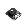
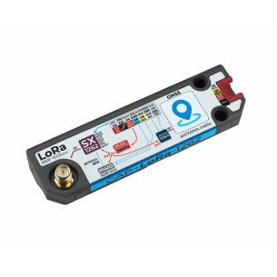
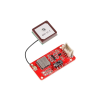
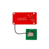
Crowtail – GP02 GPS/BDS/GNSS is a compact positioning module with support for three navigation systems, accuracy below 2 m, and a UART interface. Used in projects requiring precise real-time positioning, such as data loggers, vehicle tracking, and field devices.
The Crowtail – GP02 GPS/BDS/GNSS module integrates a satellite navigation receiver supporting the GPS, BDS (Beidou), and GLONASS systems, enabling precise multi-system positioning. The unit, based on a 32-bit RISC processor and equipped with built-in power management and active antenna detection, provides high performance with low current consumption (23 mA). It supports UART communication with a default baud rate of 9600 bps. The module offers positioning accuracy below 2 meters and an update rate of up to 5 Hz. It is suitable for outdoor applications requiring reliable and accurate location, such as autonomous vehicles, tracking systems, and data loggers.
Manufacturer BTC Korporacja sp. z o. o. Lwowska 5 05-120 Legionowo Poland sprzedaz@kamami.pl 22 767 36 20
Responsible person BTC Korporacja sp. z o. o. Lwowska 5 05-120 Legionowo Poland sprzedaz@kamami.pl 22 767 36 20
Compact GPS locator in the shape of a credit card. Equipped with GPS, Bluetooth and Wi-Fi, it ensures smooth positioning both indoors and outdoors. It not only offers location tracking, but also monitors parameters such as temperature, brightness and movement. Seeed Studio 114993073
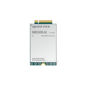
5G Sub-6GHz module optimized for IoT/eMBB applications. It supports 5G non-standalone (NSA) and standalone (SA) modes. It has an integrated high-precision multi-band GNSS receiver with support for GPS, GLONASS, BDS and Galileo positioning systems. It is equipped with an M.2 B Key connector. Waveshare RM530N-GL
No product available!
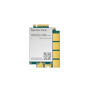
RM500U-CNV module with M.2 connector. It supports communication within 5G, 4G and 3G networks. Waveshare RM500U-CNV
No product available!
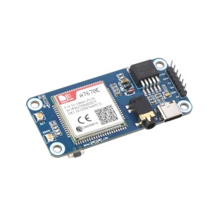
Module dedicated to Raspberry Pi, which supports various wireless communication modes, such as LTE-TDD, LTE-FDD, GSM, GPRS and EDGE. With download speeds of up to 10Mbps and upload speeds of up to 5Mbps, this module is perfect for IoT applications such as remote information processing, device monitoring, POS terminals, industrial routers, remote diagnostics and satellite positioning. Waveshare A7670E Cat-1/GNSS HAT
No product available!
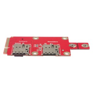
M.2 Key B to mini PCIe adapter with two NANO SIM sockets enables installation of 3G/4G/5G wireless modules in computers equipped with a mini PCI Express slot. Compatible with many WWAN standards and mobile and satellite technologies.
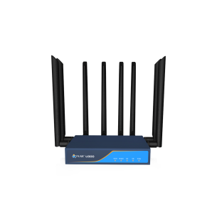
5G+Wi-Fi 6 router, offering download speeds of up to 790 Mbps on the 5G network and speeds of up to 3000 Mbps on dual-band Wi-Fi, providing exceptional speed and stability of the connection. Equipped with the Qualcomm IPQ5018 chipset and Snapdragon SDX 62 5G, the router supports Wi-Fi roaming technologies and provides high performance in demanding applications. With a metal housing, 4 SMA-K ports for external antennas and 1 micro SIM port, the U300 is a reliable solution for commercial and industrial applications. PUSR U300-G
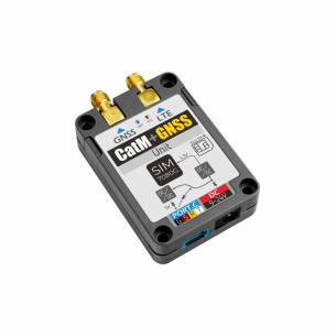
Advanced IoT module combining global LTE-M/NB-IoT connectivity with precise GNSS positioning (GPS, GLONASS, BeiDou, Galileo). With wide compatibility, two antenna interfaces and AT Command support, it is ideal for projects requiring reliable data transmission and real-time location tracking. M5Stack U137
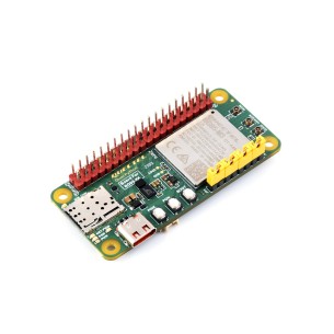
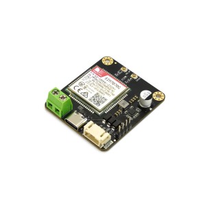
The BG95-M3 Zero development board with the Quectel BG95-M3 module enables the design of energy-efficient IoT devices operating in LTE Cat M1, NB2, and EGPRS networks. It supports multiple network protocols and GNSS positioning, offering developers and engineers an integrated development platform with support for QuecPython. Thanks to its compact design, compatibility with Raspberry Pi HATs, and battery power capability, it is ideally suited for mobile, measurement, and telemetry applications.
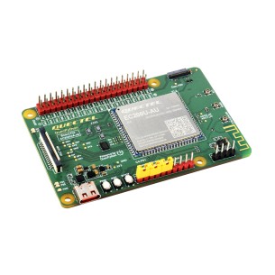
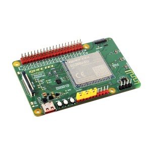
The EC200U-AU C4-P01 development board with the Quectel EC200U-AU LTE Cat 1 module enables the creation of advanced IoT applications using QuecPython. It offers extensive communication capabilities (LTE, Bluetooth, GNSS), support for multiple network protocols, and compatibility with Raspberry Pi accessories. Dedicated interfaces and development tools accelerate the prototyping process in industrial, educational, and research and development projects.
No product available!
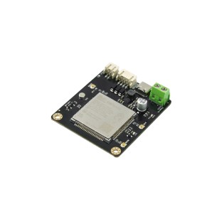
EC200U‑EU C4‑P01 is an economical and functional board for developing IoT solutions with LTE Cat‑1 connectivity, GNSS positioning, and optional Bluetooth. With support for QuecPython, HAT compatibility, and a rich set of indicators and connectors, it serves as an excellent foundation for monitoring, telemetry, and mobile communication applications.
Global NB-IoT communication module supporting CAT-M, NB-IoT, GSM and GPRS technologies, with built-in GNSS system (GPS, GLONASS, BeiDou, Galileo). It offers wide integration possibilities thanks to UART and USB interfaces, low power consumption and support for protocols such as MQTT, CoAP and HTTP, enabling quick implementation even in battery projects. It has global certifications (FCC, CE, AT&T, etc.), which guarantees compliance with international standards. DFRobot TEL0182
Advanced 4G LTE CAT4 modem with GNSS function, supporting GPS, Beidou and GLONASS, ideal for localization and communication applications. With support for multiple LTE, WCDMA and GSM bands and UART and USB interfaces, the module is compatible with platforms such as Raspberry Pi, Arduino or LattePanda. It enables data transmission, voice calls and SMS messages, and also supports TCP/IP, HTTPS and FTP network protocols, making it a versatile solution for IoT projects, vehicle tracking and security systems. DFRobot TEL0162
Universal communication module supporting 4G/3G/2G connectivity and GNSS systems, ideal for applications in monitoring, logistics and alarm systems. Thanks to UART and USB interfaces, as well as compatibility with Windows, Linux and Android systems, it can operate as a standalone device or an external network card. Support for AT commands, TCP/IP protocols and voice functions make it a versatile tool for IoT and embedded projects. DFRobot TEL0161
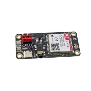
LTE CAT-1 HAT-format communication module with the SimCom A7670E-LASE modem, designed for Raspberry Pi, enabling wireless data transmission in LTE and GSM networks with support for Internet protocols and AT command control. KAmod LTE CAT1
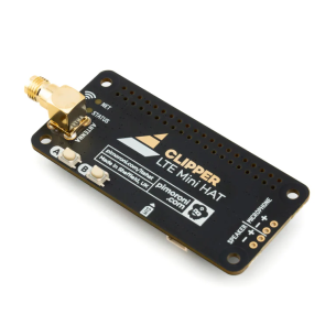
Compact 4G LTE HAT for Raspberry Pi, ideal for remote IoT projects operating without Wi-Fi. Includes SIMCom A7683E modem, SIM connector, SMA antenna, user buttons and Qw/ST port for easy expansion. No soldering required and great for mobile or field installations. Pimoroni PIM717
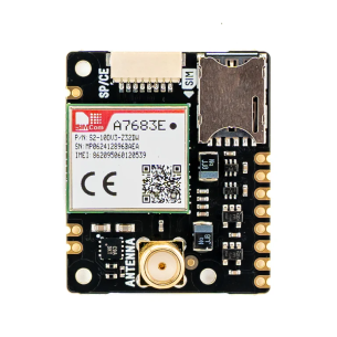
4G LTE module enabling reliable data transmission over the cellular network, ideal for IoT projects in hard-to-reach places. Equipped with an SP/CE connector, SIM slot and SMA antenna, it allows for solderless connection and quick integration with Raspberry Pi or Pico. It supports European LTE bands, and with low transfer consumption it works great with prepaid cards. Pimoroni PIM746
No product available!
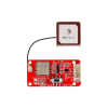
Crowtail – GP02 GPS/BDS/GNSS is a compact positioning module with support for three navigation systems, accuracy below 2 m, and a UART interface. Used in projects requiring precise real-time positioning, such as data loggers, vehicle tracking, and field devices.