


zł254.10 tax excl.
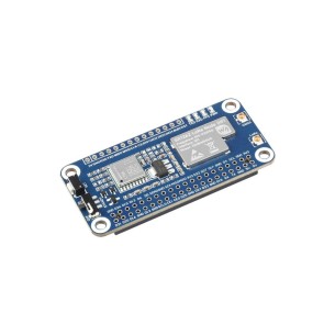
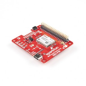
GPS module with LC29H GNSS receiver designed to work with the Raspberry Pi minicomputer. It allows you to receive data from major positioning systems, including GPS, QZSS, GLONASS, Galileo and BeiDou, and supports fast, dual-band RTK positioning. Waveshare LC29H(BS) GPS/RTK HAT

free shipping in Poland for all orders over 500 PLN

If your payment will be credited to our account by 11:00

Each consumer can return the purchased goods within 14 days
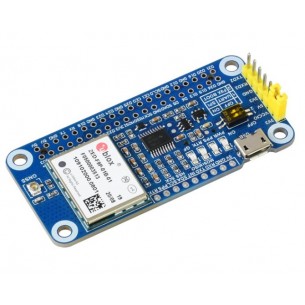
GPS module with LC29H GNSS receiver designed to work with a Raspberry Pi and Jetson Nano minicomputer. It supports simultaneous tracking of dual-band L1+L5 satellite signals and algorithms to improve positioning accuracy in urban areas. The system also offers effective suppression or elimination of narrowband signal interference (WiFi/2/3/4/5G) to ensure navigation accuracy. It allows you to receive data from major positioning systems including GPS, QZSS, GLONASS, Galileo and BeiDou while maintaining low power consumption, and support for A-GNSS (Assisted GNSS) reduces the time to first measurement acquisition (TTFF) after power-on to 5 seconds. Supports high-speed, dual-band RTK Rover positioning at centimeter level suitable for precise positioning of end devices.
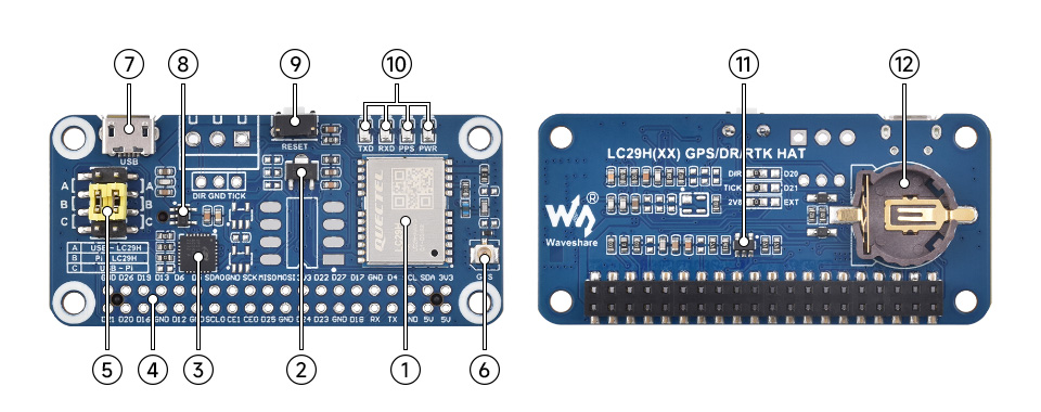
| 1. LC29H | 7. Micro USB port |
| 2. LDO RT9166A-28PXL | 8. LDO RT9193-33PB |
| 3. USB-UART CP2102N | 9. RESET button |
| 4. GPIO 40-pin | 10. Status indication |
| 5. UART jumper | 11. Voltage translator NDC7002N |
| 6. IPEX 1 connector | 12. ML1220 battery holder |
The module has a 40-pin connector compatible with Raspberry Pi. Additionally, there is a connector with a UART and I2C interface and a Micro USB port. The board also has a socket with an ML1220 battery that maintains the voltage, which significantly speeds up the start-up of the device after a temporary power outage. The user can connect an external antenna via the IPEX 1 connector. Full documentation is available on the product Wiki page.
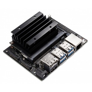
NVIDIA development kit with the ARM Cortex A57 1.43GHz CPU chip and the Maxwell graphics system consisting of 128 cores supporting CUDA technology. The module has a DDR4 4GB RAM memory. NVIDIA Jetson Nano Development Kit rev. B01 945-13450-0000-100
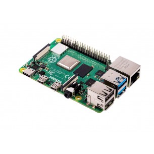
The long-awaited Raspberry Pi 4 model B with the SoC Broadcom BCM2711 SoC (4 x Cortex-A72) running at 1.5GHz, 4 GB LPDDR4 RAM and the Broadcom VideoCore VI graphics chip
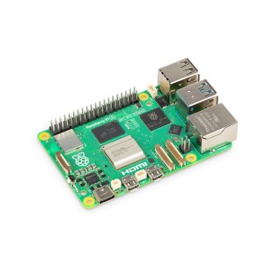
A mini-computer in version 5 with 4GB of RAM, equipped with two microHDMI ports, 2 USB 3.0 ports, and 2 USB 2.0 ports, as well as a USB-C power connector. The processor is a quad-core Broadcom BCM2712 clocked at 2.4GHz. The board also features dual-band WiFi, Bluetooth 5.0 with BLE support, PCI Express 2.0 interface, and a real-time clock. Raspberry Pi SC1111
Adafruit 2324
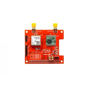
Expansion board with LoRa Node SX1262 module and GNSS L76K dedicated for Raspberry Pi. It supports the LoRaWAN protocol and allows communication in the 433 MHz frequency band and enables positioning within the GPS, GLONASS, BDS and QZSS systems. Waveshare SX1262 433/470M LoRaWAN/GNSS HAT
Expansion board with LoRa Node SX1262 module and GNSS L76K dedicated for Raspberry Pi. It supports the LoRaWAN protocol and allows communication in the 868 MHz frequency band and enables positioning within the GPS, GLONASS, BDS and QZSS systems. Waveshare SX1262 868/915M LoRaWAN/GNSS HAT
GPS module with GNSS receiver ZED-F9P. It can receive data from GPS, GLONASS, Galileo and BeiDou systems. It has USB, UART, I2C and SPI interfaces. RTK and high accuracy up to 10 mm. Waveshare ZED-F9P GPS-RTK HAT
No product available!
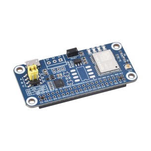
GPS module with LC29H GNSS receiver designed to work with the Raspberry Pi minicomputer. It allows you to receive data from major positioning systems, including GPS, QZSS, GLONASS, Galileo and BeiDou, and supports the RTK function as a base station. Waveshare LC29H(DA) GPS/RTK HAT
No product available!
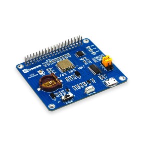
GNSS receiver module dedicated to Raspberry Pi minicomputers. It provides simultaneous reception of up to three types of satellite systems, including GNSS with GPS, Beidou, Galileo and GLONASS. Waveshare NEO-M8T GNSS TIMING HAT
No product available!
KAmodRPi-GPRS-GPS is an overlay for Raspberry Pi 4 / 3B + / 3B / 2B / B + computers, which allows you to enrich the system with the ability to send data via GPRS, SMS transmission or work as a module for Bluetooth communication. This extension also offers the ability to receive satellite data from location systems - GPS and GLONASS.
GPS module with u-blox ZED-F9R. Uses Automotive Dead Reckoning (ADR) technology. Provides highly accurate and continuous positioning by combining the 3D IMU sensor, vehicle dynamics model, correction data and GNSS measurements. SparkFun GPS-16475
No product available!
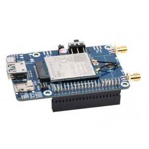
Kit with the LTE Cat-6 EM06-E module designed to work with the Raspberry Pi minicomputer. It supports communication within the fast LTE-A network and GNSS positioning. Waveshare EM06-E LTE Cat-6 HAT
No product available!
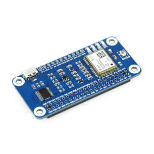
GPS module with LC29H GNSS receiver designed to work with the Raspberry Pi minicomputer. It allows you to receive data from major positioning systems, including GPS, QZSS, GLONASS, Galileo and BeiDou, and supports positioning assistance systems (WAAS, EGNOS, MSAS and GAGAN) and EASY technology. Waveshare LC29H(AA) GPS HAT
No product available!
Small GPS location module with L80-39 GPS chip, USB and TTL two ports,easy to be used with Raspberry Pi, Arduino, STM32 and other kind of micrcontrollers. The GPS module uses NMEA0183 communication protocol, integrated ultra-small SMA antenna connector. DFRobot TEL0119
GNSS module based on the L76B chip that can work with GPS, BDS and QZSS systems. Communication via a UART interface. SB Components 24056
Seeed studio LoRa / GPS HAT is an extension designed for Raspberry Pi 2 minicomputers (model B) and Raspberry Pi 3. It has a LoRa communication module (868 MHz) and a GPS module. Seeed Studio 113990254
No product available!
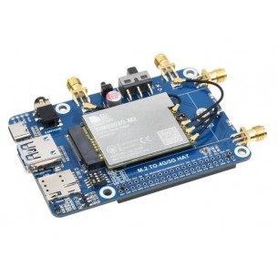
Set with SIMCom 5G SIM8202G-M2 module designed to work with the Raspberry Pi minicomputer. It supports 5G SA or NSA networks and is backwards compatible with 4G and 3G networks. Waveshare SIM8202G-M2 5G HAT (B)
No product available!
GPS module with LC29H GNSS receiver designed to work with the Raspberry Pi minicomputer. It allows you to receive data from major positioning systems, including GPS, QZSS, GLONASS, Galileo and BeiDou, and supports fast, dual-band RTK positioning. Waveshare LC29H(BS) GPS/RTK HAT