


- New


zł2,062.67 tax excl.
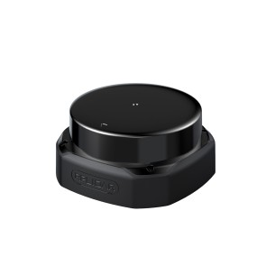
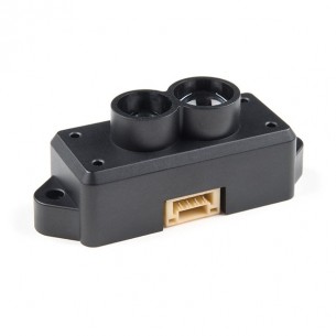
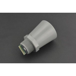
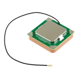
2D DTOF Lidar with a range of up to 30 m (90% reflectivity), 32000 measurements/s, 0.12° angular resolution, Ethernet UDP 10/100M communication, IP65 protection rating, 12 V supply voltage. Slamtec RPLIDAR S2E
RPLIDAR S2 supports 2D mapping and mobile robot navigation in both indoor and outdoor environments, providing high-resolution scan data with stable repeatability. DTOF technology maintains consistent ranging resolution across the entire operating distance, while the IP65-rated enclosure supports deployment in industrial environments exposed to dust and water splashes.
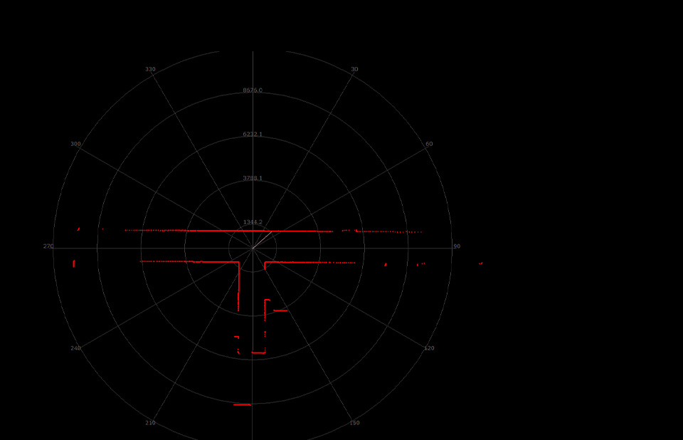
The measuring range depends directly on the reflectivity coefficient of the detected object, which is of significant importance when designing navigation and safety systems. For surfaces with high reflectivity of 90%, the maximum detection distance is 0.05 - 30 m, corresponding to bright walls, structural elements, or obstacles with a high reflection coefficient.
In the case of objects with 10% reflectivity, such as dark plastics, rubber tires, or matte surfaces, the effective operating range is 0.05 - 10 m. This dependency allows precise estimation of the actual system operating range in the target environment, particularly in industrial, warehouse, or commercial spaces where various materials and surface colors are present. The minimum measurement distance of 0.05 m reduces the blind zone in the near field, improving obstacle detection accuracy during wall-following, navigation in narrow passages, and robot docking operations.
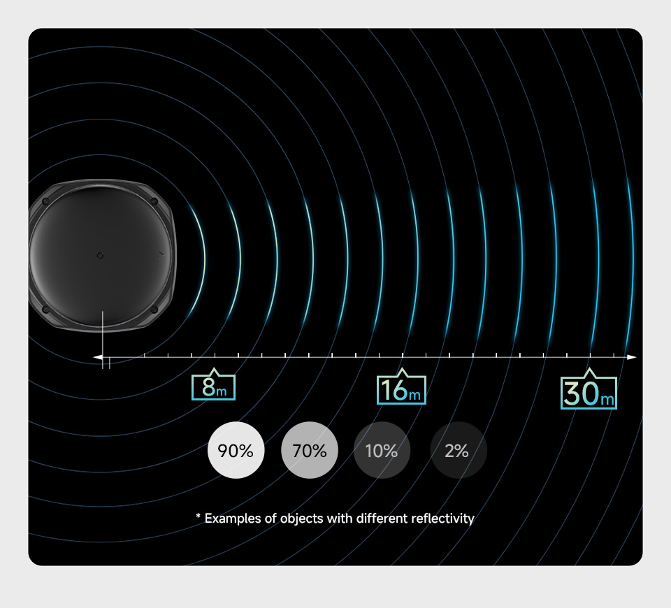
The DTOF method measures distance based on the time of flight of a laser beam, which allows consistent distance resolution to be maintained regardless of whether the obstacle is located near or far. This measurement approach supports detection of objects with varying optical properties, including dark surfaces, highly reflective materials, and transparent elements, which improves the reliability of map data in mixed environments.
A sampling rate of 32000 measurements per second increases data density during scanning and allows more environmental details to be reconstructed during mapping and localization. The 0.12° angular resolution supports precise representation of edges, corners, and narrow obstacles, while the 10 Hz scan rate ensures a stable, cyclic data stream during navigation in motion. Such parameters improve the quality of environment reconstruction in SLAM algorithms and increase the effectiveness of detecting dynamic objects in real time.
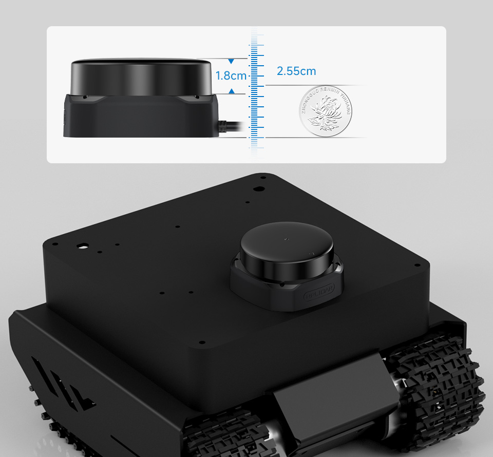
The compact design with an optical scanning height of 18 mm enables integration with mobile platforms, service robots, and AGV systems without the need for significant structural modifications. The device dimensions correspond to typical design requirements imposed on navigation modules used in commercial and industrial robotics, where limited mounting space and a low sensor profile are key component selection criteria.
The optimized enclosure form facilitates installation in standard structural recesses, sensor modules, and under protective covers, while maintaining proper exposure of the 360° scanning zone. The low-profile construction supports proper center-of-gravity distribution of the platform, which is important in mobile robots with high dynamic motion. The design also meets aesthetic and integration requirements of robots deployed in commercial environments such as hotels, shopping malls, and office buildings, where combining functionality with a compact, integrated form is essential.
RPLIDAR S2 combines stable DTOF technology, high sampling density, and a compact design, delivering precise 2D scanning tailored to the requirements of modern robotic systems operating in commercial and industrial environments.
Data sheet
Manufacturer BTC Korporacja sp. z o. o. Lwowska 5 05-120 Legionowo Poland sprzedaz@kamami.pl 22 767 36 20
Responsible person BTC Korporacja sp. z o. o. Lwowska 5 05-120 Legionowo Poland sprzedaz@kamami.pl 22 767 36 20
2D lidar sensor based on DTOF technology with measuring range up to 50 m (90% reflectivity), sampling rate 32000 samples/s, angular resolution 0.12°, UART 1 Mbps interface, IP65 protection rating, 5 V supply voltage. Slamtec RPLIDAR S2P
No product available!
2D lidar using DTOF technology with a range of up to 18 m (90% reflectivity), 32,000 samples/s sampling rate, 0.12° angular resolution, UART 1 Mbps interface, IP65 protection rating, 5 V supply. Slamtec RPLIDAR S2L
No product available!
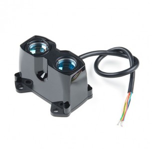
LIDAR-Lite v3HP is a laser rangefinder with a measuring range of 5 cm ... 40 m. Power consumption is a maximum of 85 mA. Supply voltage in the range 4.75 ... 5 V. Class 1 laser. I2C or PWM interface. SparkFun SEN-14599
No product available!
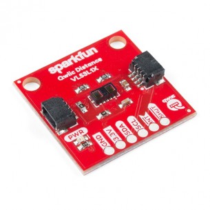
Distance Sensor Breakout VL53L1X is a distance sensor with a range of 4m and a supply voltage of 2.6 ... 3.5V. Communication with the sensor takes place via the I2C interface. SEN-14722
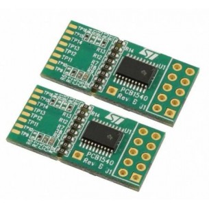
Satellite board can be used for easy integration into customer devices and basic gesture detection applications.Thanks to its 2.8V regulator and level shifters, the VL53L0X satellite board can be used in any application with a 2.8 to 5V supply
TF Mini LiDAR is a one-way rangefinder that is based on ToF (Time of Flight) technology. It consists of high quality optical and electrical devices that provide stability, high sensitivity and precision. Sparkfun SEN-14786
No product available!
Laser scanner (Lidar) 360 degrees with a measurement frequency of 10 Hz and 16,000 measurements / second. Range up to 25m, measuring error at 1%. Sparkfun SEN-15045
No product available!
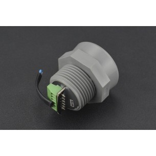
Ultrasonic distance sensor (sonar) with a measuring range from 50 cm to 10 m. It allows you to read data through one of three interfaces: variable width pulse, analog output or UART TTL interface. DFRobot SEN0271
No product available!
Ultrasonic distance sensor (sonar) with a measuring range from 50 cm to 5 m. It allows you to read data via an industrial analog interface with a current output of 4-20 mA. DFRobot SEN0266
No product available!
Ultrasonic distance sensor (sonar) with a measuring range from 50 cm to 5 m. It allows you to read data via an industrial analog interface with a current output of 4-20 mA. DFRobot SEN0267
No product available!
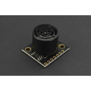
Ultrasonic distance sensor (sonar) with a measuring range from 30 cm to 500 cm. It allows to read data through one of three interfaces: variable width pulse, analog output or RS232/TTL interface. DFRobot SEN0269
No product available!
Ultrasonic distance sensor (sonar) with a measuring range from 30 cm to 5 m. It allows you to read data via the USB interface. DFRobot SEN0270
No product available!
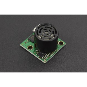
Ultrasonic distance sensor (sonar) with a measuring range from 15 cm to 645 cm. It allows you to read data through one of three interfaces: variable-width pulse, analog output or RS232 interface. DFRobot SEN0275
No product available!
Ultrasonic distance sensor (sonar) with a measuring range from 15 to 645 cm with the possibility of detecting objects in a selected zone. It allows you to read data via the RS232 interface. DFRobot SEN0276
No product available!
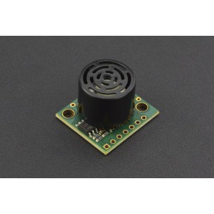
Ultrasonic distance sensor (sonar) with a measuring range from 15 to 318 cm with the possibility of detecting objects in a selected zone. It allows you to read data via the USB interface. DFRobot SEN0279
No product available!
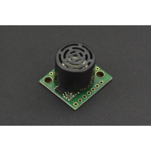
Ultrasonic distance sensor (sonar) with a measuring range from 25 cm to 1068 cm. It allows you to read data through one of three interfaces: AE (analog envelop), analog output or RS232 interface. DFRobot SEN0280
No product available!
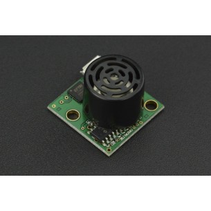
Ultrasonic distance sensor (sonar) with a measuring range from 25 cm to 1068 cm. It allows you to read data through one of three interfaces: variable width pulse, analog output or RS232 interface. DFRobot SEN0281
No product available!
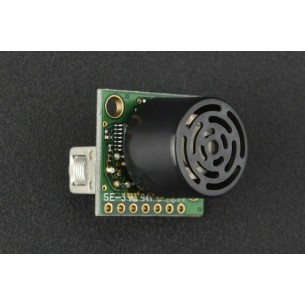
Ultrasonic distance sensor (sonar) with a measuring range from 20 cm to 10.64 m. It allows you to read data through one of three interfaces: variable width pulse, analog output or RS232 interface. DFRobot SEN0282
No product available!
2D DTOF Lidar with a range of up to 30 m (90% reflectivity), 32000 measurements/s, 0.12° angular resolution, Ethernet UDP 10/100M communication, IP65 protection rating, 12 V supply voltage. Slamtec RPLIDAR S2E